Innovation Spotlight
Innovation Spotlight: Drones at the High-Speed Rail Project

“I’m a paper kind of guy.”
Flatiron Environmental Manager Philip Lappe loves new technology that can help his team do the job better. But he’s also a self-admitted skeptic. He always goes the extra mile to make sure that new tech is truly going to innovate the work he does on the more than 60-mile California High-Speed Rail Construction Package 2-3 Project (Flatiron is a joint venture partner alongside Dragados USA).
Drones however, and apologies for the cheesy play on words, passed with “flying” colors according to Lappe.
The joint venture’s large environmental compliance operation is one of many areas utilizing unmanned aircraft systems (UAS) to monitor the project’s progress. These are aerial vehicles outfitted with advanced geomapping software. Or as Lappe puts it: “These aren’t the drones you can get at your neighborhood retail electronics store.”
Besides delivering accurate results without damaging a project’s access roads during or after rain events, they can get into zones that are either impassable or possibly dangerous. After a storm, certain areas of the project can be impassable for up to two weeks.
Recently Lappe was challenged with having to micro-map every habitat on the project to remain in compliance with the California Department of Fish and Wildlife permits. Micro-mapping habitats is crucial because it provides the resource agencies a highly accurate accounting of each habitat type impacted by the project. The operation entails breaking down each parcel of land into numerous habitats (instead of mapping an entire parcel for just the dominant habitat). The proper accounting of impacted acres is key in securing suitable mitigation acres for the area’s endangered species, so they have the space needed to continue to thrive into the future.
Using drones operated by environmental subcontractor Dudek, Lappe’s team was able to save an astonishing amount of time. Here is how he explains it: “It took a few weeks to map the whole alignment. We had to set out all the targets so that we could triangulate locations. However, if we were to map it in the field, it would have taken months and months. Each polygon of the habitat would have to be walked and mapped individually with a Trimble or total station, before additional work classifying each habitat and deducing its acreage.”
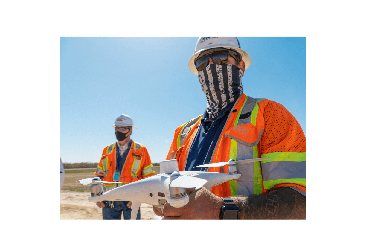
In addition to environmental compliance, the project’s survey team is benefitting from UAS as well. They use a DJI model drone armed with advanced photogrammetry software that uses photo imagery to develop a digital surface model. Using their drone alongside other technologies like real-time kinematic GPS, the team is offering better readouts faster to internal stakeholders.
How much faster? Topographical surveys to gather land points and produce a design surface model might have taken surveyors 8-16 hours using conventional methods. The drones can gather the same data over the same amount of land in as little as an hour (up to four hours). With quantity monitoring for example (one area where drones have been a game changer), this difference in time is crucial. If there’s a difference in the amount of dirt the crews believe is being removed from excavation sites, versus what’s actually being taken away, the project will know that much sooner. The accuracy is higher, yielding ground elevations at centimeter intervals, versus 10-50′ intervals with conventional surveys. Also, the use of the drone provides real-time ground surface model for design changes that are available just 24 hours after the flight.
The joint venture’s surveyors regularly fly their units to build topographical surveys to monitor progress, both over embankments and structures. They point out that reaching the heights necessary to survey a bridge would have previously been impossible, short of flying a fixed wing aircraft. But while a plane would have been stuck up at more than 4,000 feet, a drone can hover at around 330 feet, gaining a much closer look.
The joint venture’s drone pilot also takes progress photos once a quarter, meticulously flying over the project’s dozens of miles.
Between the information gathered by the drones, working alongside GPS units, the project’s surveyors say their data is accurate to within a hundredth to five hundredths of a foot.
Surveyors at the massive project believe drones will only grow in construction project usage. They add cutting edge models can drive small stakes (pegged with QR codes to reveal data about the point) into the ground. Innovations like these might be as common someday as the excavator or the concrete paver.
As Lappe says: “You could do full days’ worth of inspections in just a couple of hours and be done. I think it’s going to be used a lot more in the future than it is now.”
Video: Go behind the scenes with the High-Speed Rail Project’s survey team on a drone flight
CONTACT
Jason Evans
Marketing & Communications
JEvans@flatironcorp.com
